Superhot rock geothermal wells could help the United States meet rising electricity demand. However, a lack of geological information means that drilling these expensive wells is risky. Two types of government programs could support efforts to gather useful geological data across the country.
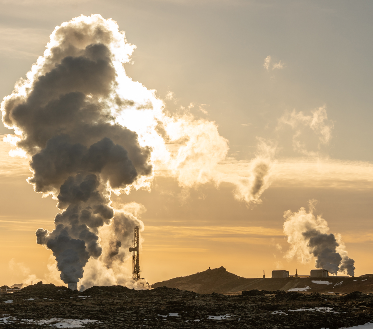
For at least the next decade, US electricity demand is projected to rise significantly due to data centers and rising electricity needs. The United States, accordingly, will need to expand its electricity generation and replace retiring generation. Geothermal-based electricity has the potential to become a significant source of electricity. However, it needs more federal assistance to achieve its full potential, which lies, in part, with gaining a better understanding of the geology of superhot rocks, which have temperatures of 375˚C or higher.
Unlike with oil and gas exploration, financing exploratory enhanced geothermal energy wells (i.e., those tapping hot resources under 375˚C) is very risky. Superhot rock targets are even more risky, because so little data is available about depth, temperature, and other aspects of the hot rock that developers seek. Moreover, the technology for reaching, understanding, and tapping these high-temperature and high-pressure areas needs to be improved. A company seeking financing for geothermal development has to find lenders that will take the risks of a well having insufficient energy over a period long enough for a positive rate of return to be gained. Thus, geothermal financing challenges are greater than those for oil and gas exploration.
Roughly east and west of the Mississippi River, we see a difference in the pressure and depth of superhot rocks and have different understandings of productive locations to drill. Because of this variation, we envision two types of possible government programs to support gathering useful geological information. We propose that the geology data issues in the East be addressed through public intervention and those in the West through particular incentive policies.
Geothermal System Types
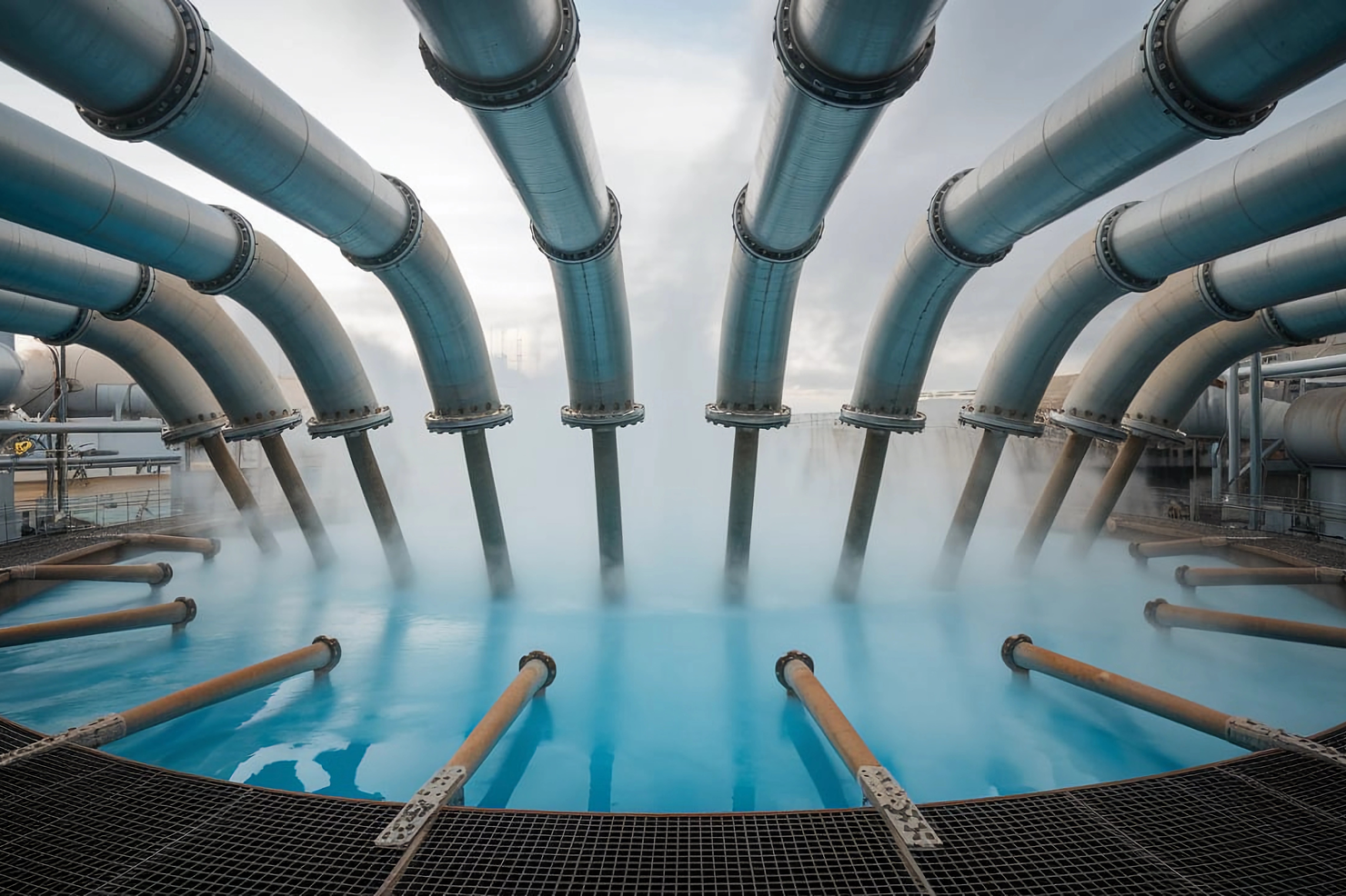
There are basically three types of geothermal power systems. Hydrogeothermal involves tapping an underground aquifer with temperatures from 160˚C to 300˚C. Such aquifers are generally close to the tectonic belt referred to as the Ring of Fire, which includes the Western edge of the United States. Enhanced geothermal power systems involve the drilling of two wells for hot dry rock: one well for injection of water to extract heat and the other to bring the very hot water back to the surface to the power plant. The range of temperatures for this system is 150˚C to 375˚C. Superhot rock geothermal operates at 375˚C and higher and involves heating water to a supercritical fluid state, which is much more energy dense and transports heat more efficiently than the water used in conventional geothermal systems. The appeal of developing superhot rock geothermal electric power is that much more electricity can be generated by a single well.
Superhot Rock Location
The lack of understanding about where productive superhot rocks can be found, particularly in the Eastern United States, limits exploratory efforts. According to a 1987 paper by US Geological Survey (USGS) researchers Nathenson and Guffanti, the average increase of temperature as depth increases is 25˚C per kilometer in the East and 34˚C per kilometer in the West. This means that developers would have to drill down 15 kilometers in the East and 11 kilometers in the West on average to reach superhot rock. These averages are a useful guide, but without much exploration, precise locations will remain highly uncertain.
Work from Southern Methodist University shows one estimate of which parts of the United States have the highest subterranean temperatures at a depth of 10 kilometers. Although enhanced geothermal electricity production happens in the Western United States, none occurs in the Eastern portion, in part because temperature maps are inadequate. Maps like this make subterranean temperatures seem more certain than they actually are, as no one has any direct observation of temperatures at these depths.
The current lack of data about depth and rock temperature makes geothermal exploration riskier and, therefore, tougher to finance than oil and gas exploration.
Geological maps are inferences from geophysical observations that require physics-based modeling and assumptions about crustal properties. The accuracy of the maps depends on the quality of the geophysical data, how much physics is accounted for in the models, and how well the assumptions match the actual Earth.
The bottom line is that the current lack of data about depth and rock temperature makes geothermal exploration riskier and, therefore, tougher to finance than oil and gas exploration.
Better Strategies for Federal Support to Obtain Needed Geological Information
In the Energy Act of 2020, Congress authorized USGS to undertake major tasks related to geothermal energy but has not funded that work. Geothermal development in the Eastern United States would benefit greatly from work funded and performed through that legislation. Even more importantly, the law empowers USGS to develop new temperature maps down to about seven kilometers for Alaska and the Eastern part of the United States, since these maps will support progress on provisions in the Energy Act.
Because of the differences in geothermal development and knowledge between the Eastern and Western United States, we envision two types of possible government programs to support gathering useful geological information. The program for the East would involve USGS obtaining and publishing more information. For the Western program, the federal government would partially compensate companies that must abandon unproductive deep wells in return for the companies’ drilling and geological data.
In the West, more geological information is known that is useful for geothermal development. One policy program variation could be for the US Department of Energy (DOE) to offer a given percentage of the cost of an exploration well (including drilling, casing, logging, and completion), in the event that the well is nonproducing but reaches 375˚C rock or 20,000 feet in depth. The second variation is an insurance option, with DOE offering a given percentage compensation to the operator(s) that are willing to pay the highest fee or insurance premium for that compensation, should the well be nonproducing.
Credit: Alrasyiqin / Shutterstock
The cost of such wells is uncertain. According to one estimate, the cost of drilling an enhanced geothermal well in the West to 13,000 feet is about $4 million to $10 million, depending in part on the diameter of the well. For a well 23,000 feet deep, that cost range rises to $6 million to $13 million. Superhot rock wells could be even more expensive.
In return for the funding, the operator would provide DOE with data, which DOE then would make publicly available to help reduce uncertainties and encourage additional drilling. The percentage share of government assistance could be determined in an auction, with the winning bids having either the lowest percentage share or the lowest absolute amount of government support.
The data that the US government could request from a geothermal operator would be the kind of information that is customarily provided in daily drilling reports and end-of-well reports for typical oil and gas exploration wells. These data include prognosed and encountered stratigraphy; designed and installed casing and liners; drilling parameters like bit specs, mud weight, weight on bit, torques, and rate of penetration; wireline logs and measured temperatures; and constraint data on the physical properties of the crust, like thermal conductivity and radiogenic heat potential, that will make inferences from geophysical observations more accurate.
In the first year of such a program, at least one auction could be held in Nevada, Idaho, Oregon, Utah, Colorado, and New Mexico. These states have large areas of 400˚C rock and have few areas of geothermal energy production.
In an effort to maximize the value of information, each compensated well must be far enough apart from other geothermal wells to provide high-quality and uncorrelated information. A geologist at DOE or a national laboratory could decide what constitutes “too close.”
What’s Next
One of the biggest challenges in developing geothermal energy is obtaining financing for exploratory wells because the risk of failure is so high. One way to reduce that risk is to gain a much better understanding of resource location, temperature, and likely productivity. To support faster development of geothermal energy, the government could consider two different programs for the Eastern and Western United States. USGS could do surveys of the Eastern United States like it has done in the West, with an initial focus on states with the largest and hottest areas close to the surface.
In addition, DOE could compensate operators of nonproducing wells in at least four Western states yearly, given that these wells reach 20,000 feet or 375˚C, their data is made publicly available, and the well is not “too close” to any other geothermal well.