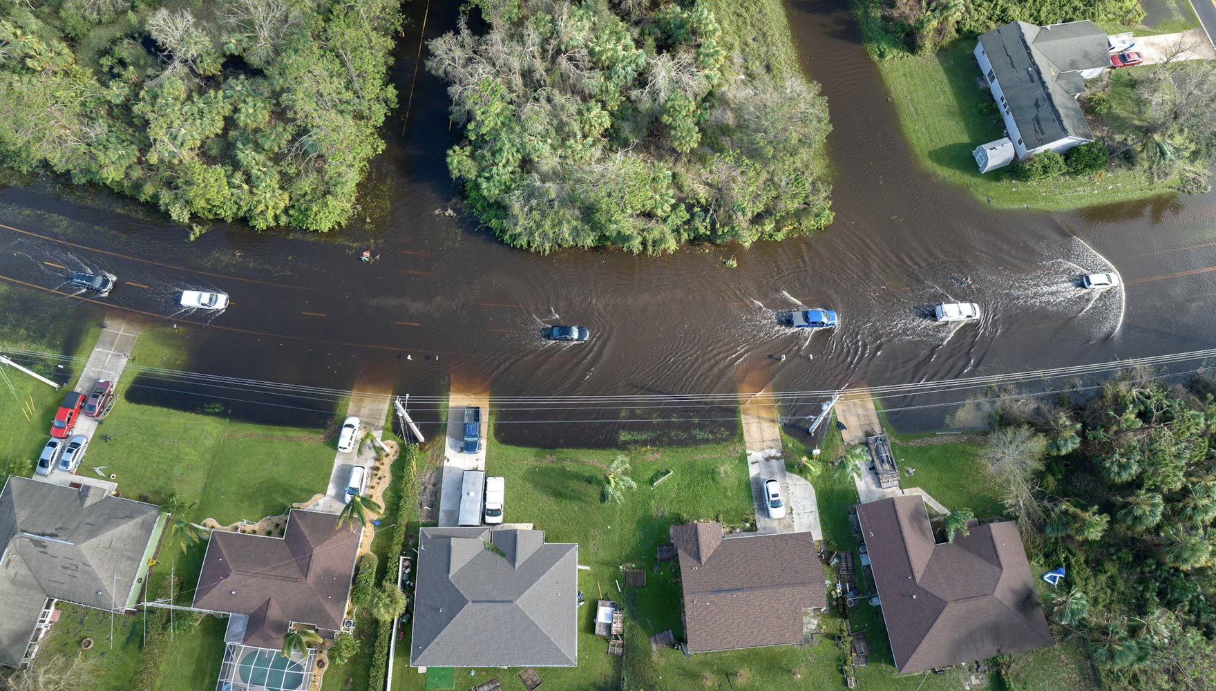

In this episode, host Kristin Hayes talks with Jesse Gourevitch, a new Resources for the Future fellow, about how flood-risk information affects US housing markets. Discussing an upcoming report, Gourevitch outlines changes in property sale prices and buyer characteristics following revisions to federal flood maps and updates to state requirements for disclosing flood risk to homebuyers. He and his coauthor have found that property sale prices are lower when properties are mapped into a designated flood zone or become subject to disclosure requirements. For lower-income homeowners, the declines in property value are larger than high-income homeowners relative to annual income. Following these changes to flood maps, homebuyers in flood-prone areas tend to have higher incomes and are less likely to be Black or Hispanic. Gourevitch discusses what these findings could mean for disparities in flood exposure across different socioeconomic groups.
Listen to the Podcast
Audio edited by Rosario Añon Suarez
Notable Quotes
- Federal flood-risk information is outdated and inaccurate: “Historically, the [Federal Emergency Management Agency’s] flood insurance rate maps have been one of the primary mechanisms for communicating a property’s flood risk to prospective homebuyers. However, it’s well known that these maps are often outdated, they can lack coverage in parts of the country, and they also ignore what’s known as pluvial flooding caused by heavy rainfall.” (6:32)
- Map revisions reshape flood zones: “Over the past two decades, flood insurance rate map updates have rezoned about 1 million properties into the special flood hazard area, and rezoned 2.4 million properties out of the special flood hazard area, resulting in a net decrease of more than 1.4 million properties out of that high-risk flood zone.” (13:37)
- Declines in property value disproportionately affect lower-income homeowners: “When properties are remapped into the special flood hazard area, the drop in value represents about 12 percent of the annual income for a household with an income of $50,000, but only a nine percent of the annual income for households with an income of, say, $200,000.” (19:11)
Top of the Stack
- Who is Government? The Untold Story of Public Service by Michael Lewis
The Full Transcript
Kristin Hayes: Hello, and welcome to Resources Radio, a weekly podcast from Resources for the Future (RFF). I’m your host, Kristin Hayes. My guest today is RFF’s newest fellow, Jesse Gourevitch, who joined RFF in August of 2026.
Jesse earned his PhD in natural resources at the University of Vermont before spending some time in academia as a postdoc at the University of Pennsylvania and the University of California, Davis. He then transitioned to work as an economist at the Environmental Defense Fund for several years before coming to RFF. Jesse’s research focuses primarily on climate risks and resilience with a particular focus on flooding. And today we’re going to be talking primarily about his work on impacts of updating flood risk information in US housing markets. He’ll also give our listeners a flavor of his other broad range of interests and expertise. So stay with us.
Hi, Jesse, and welcome to Resources Radio. This is kind of a rite of passage for new fellows, so it’s great to talk with you today.
Jesse Gourevitch: Thanks, Kristin. It’s great to be here.
Kristin Hayes: Well, let’s start with our usual general introduction. But in addition to that, in your case, I would like to ask you to say a little bit more about what drew you to working at RFF. So, who you are in general and then what brought you to Resources for the Future?
Jesse Gourevitch: Sure. So, I started at RFF at the beginning of August, and before that, I worked at Environmental Defense Fund (EDF) for about three and a half years on their economics team. Prior to joining EDF, most of my research in graduate school centered on quantifying and valuing the provision of ecosystem services—with a particular focus on understanding how flood mitigation benefits from wetland and floodplain restoration were distributed among different demographic and socioeconomic groups across the United States.
Since finishing my PhD, my research interests have evolved somewhat to primarily focus on physical climate risks and adaptation, particularly focusing on housing, insurance, and mortgage markets. So much of this work aims to understand the economic and financial risks associated with climate impacts in these markets. My work also seeks to understand how different public policies have been designed to incentivize risk reduction and promote adaptation and how effective those policies are in affecting that change.
So, since beginning my PhD, I’ve always cared a lot about doing research that is used and that is useful. In general, what drew me to working at RFF is the really strong emphasis on combining rigorous economic research with state and federal policy engagement. In my view, RFF is one of the few organizations that does both of those things really, really well. And I’ve long admired the people here and the work that they do. RFF also just has an incredible team of people working on a range of issues related to climate risk and resilience, as well as climate-related financial risks. And I’m very excited to have the opportunity to collaborate with that group more closely.
Kristin Hayes: That’s great. I know you worked with several RFFers in your previous capacities, as well, so this was also sort of a reunion of sorts, bringing you officially into the fold with some of our other colleagues who work on risk and resilience. So, nice all around. I know they were very excited to have you join the RFF team, and thanks for those kind words about the institution that we’re very glad to have you at.
Okay, so let’s talk a little bit more about the substance of one of your papers. There are many things to choose from, but on Resources Radio, we find that in general, we want to have an episode do a little bit of a deeper dive. So, today we’re going to talk about your work with your colleague, Stephen Billings, and the title of the paper is Distributional Impacts of Updating Flood Risk Information.
So, I want to start with just a quick definitional question. I think we’ve thrown around the term distributional impacts on Resources Radio before, but just in case it’s been a while, what are you looking at when you talk about distributional impacts?
Jesse Gourevitch: Yes, great question. So, in the paper, we examine two distinct outcomes associated with updating information about flood risk with a particular focus on US housing markets. And so, for each of those outcomes, we evaluate whether there are heterogeneous impacts depending on certain household characteristics such as race, ethnicity, and income.
So, our first outcome examines how changes in flood risk information relates to sale prices among properties that are exposed to flood risk. This is a question that has been examined in many previous studies, and consistent with those studies, we tend to see negative effects on sale prices. However, we take our analysis a bit further by looking at whether certain types of households are disproportionately impacted by this loss in property value.
Our second outcome is then focused on the distributional impacts of changes in exposure to flood risk. So, in general, the location where a household chooses to live is a key determinant of the probability of them being impacted by a flood. So, a policy that changes the provision of information about properties’ exposure to flood risk could therefore alter how households make decisions about where they purchase a home.
With our analysis, we ask whether this new information about whether a property is prone to flooding then changes the compositions of the households that are exposed to flood risk.
Kristin Hayes: Okay. So, it’s really about the distribution of information provision across a range of populations, as you mentioned, based on a set of demographic characteristics that I think our audience will be familiar with.
But I want to pick up on one thing that you said right there: this idea that information provision makes a big difference to decision making. But you also note pretty early on in the paper that, and I’m going to quote here for a second, that “Information about properties’ exposure to flood risk has historically been underprovided and difficult to access.”
So, information really matters, but it sounds like it’s been hard to get to. And why has that been the case? And also, what are some of the consequences of previous deficiencies in accessing that information?
Jesse Gourevitch: There are several distinct reasons for those deficiencies in flood risk information. Historically, the [Federal Emergency Management Agency’s] flood insurance rate maps have been one of the primary mechanisms for communicating a property’s flood risk to prospective homebuyers. However, it’s well known that these maps are often outdated, they can lack coverage in parts of the country, and they also ignore what’s known as pluvial flooding caused by heavy rainfall.
Those maps are also based on historical climate conditions and do not provide people with information about how flood risk has changed in more recent years or how it is expected to change in the coming decades.
It’s also important to note though that these maps were never originally intended or designed to communicate future flood risks under climate change. They were developed more for regulatory purposes; yet, at the same time, there does not exist alternative governmental or government regulated sources of predicted forward-looking flood-hazard information, particularly at a national scale.
FEMA’s flood maps also primarily focus on identifying what is known as the modeled 100-year floodplain, or areas that have a greater than or equal to 1 percent probability of flooding each year, which is referred to as the special flood hazard area, or SFHA. And so, this SFHA was primarily used for insurance purposes requiring homeowners with mortgage properties to carry flood insurance, but its now-widespread use in flood-risk communication tends to create this false-binary distinction between properties that are exposed to high flood risk and those that are not.
Another issue with these maps is access. So, where I live in Vermont, large parts of the state do not have digitized versions of FEMA’s flood insurance rate maps, which makes it very challenging for prospective home buyers to learn about a property’s exposure to flood risk. So, as a result of these many deficiencies, current and prospective home buyers might not be aware of a property’s exposure to flood risk and the costs that come associated with that.
And this can have a range of consequences for households. So, if a property is outside of the special flood hazard area and unaware of their exposure to flood risk, then they’re much less likely to purchase flood insurance or invest in certain types of flood-mitigation measures. And in some instances, if a household did have that information, that may have led them to purchase a different home entirely.
Kristin Hayes: Can I follow up quickly on that point, too? So, it sounds like there has been a fair amount (maybe that’s not a fair characterization), but certainly some work in the past about understanding that when this information is made available to people, that their decisions do change. So, what do we know about how and maybe how much that information really does change purchasing decisions? Is it a big impact that happens when that information is provided or is available relatively small? What are the margins on which that information is changing decisions? I’m curious.
Jesse Gourevitch: Yes. So, when that information is available to homebuyers, it can have significant impacts on their purchasing behaviors. So, we know from previous research that, given that information about flood risks, households may adjust their search bidding and final purchasing decisions,leading them to trade off other housing amenities in order to lower their exposure to flood risk.
However, household responses to this information can depend on a pretty wide array of factors, including differences in a household’s ability to pay to avoid exposure to flood risk, their beliefs about climate change, political affiliation, and the ability to access other housing options.
Though, in general, what we see is that low-income Black and Hispanic households tend to be disproportionately exposed to flood risk at local to national scales across the US. And there has been pretty widespread evidence indicating that these disparities are particularly acute for what’s known as hidden flood risk, or in other words, flood risk that is outside of federally designated flood zones.
And so, while there may be many factors that could be driving this disproportionate exposure, information failures may be playing an important role in that residential sorting or those household location decisions.
Kristin Hayes: Very interesting, Jesse. I’m going to take host prerogative for a second and go back to one piece of information that you mentioned earlier, which is that the maps also don’t incorporate (I forget the word you used—) “pluvial,”—is that the word? Heavy rain…
Jesse Gourevitch: Yes.
Kristin Hayes: … very heavy rain events. I’m sorry, but I have to ask you about that because that’s very fascinating to me. This is a flood map, right? How does a flood map not incorporate heavy rain events? Can you just say a little bit more about how that came to be?
Jesse Gourevitch: Yes. So, FEMA’s flood insurance rate maps typically focus on flooding from two sources. One is flooding from coastal storm surge and the other is flooding from riverine flood risk—when rivers overtop their banks and inundate surrounding areas. What the maps have omitted historically is what’s known as pluvial flood risk—when there’s heavy rainfall and that rainfall pools in depressed or low lying areas. That just has not been well mapped.
Kristin Hayes: Interesting. Okay, Jesse, that’s great. You’ve given us a good lens into these tools, but I’d love to give you a chance to say just a little bit more about maybe how they’re updated, maybe how they come together in the analysis that you did, if there are other tools or data sources that you were looking at. Talk to us just a little bit more about the data sources and tools that you used in this analysis.
Jesse Gourevitch: Yes. So, in the paper, we look at two different forms of flood-risk information updates.
The first are updates to FEMA’s flood insurance rate maps. These map updates occur periodically over time, and they result in some properties being rezoned into or out of the special flood hazard area. So, in effect, this provides new information about a property’s exposure to flood risk. These map revisions can occur for a variety of reasons, including updates to data availability and flood modeling best practices, or following major flood events that reveal map deficiencies. So, over the past two decades, flood insurance rate map updates have rezoned about 1 million properties into the special flood hazard area and rezoned 2.4 million properties out of the special flood hazard area, resulting in a net decrease of more than 1.4 million properties out of that high-risk flood zone.
Kristin Hayes: Interesting. Okay.
Jesse Gourevitch: So, in addition to FEMA’s flood insurance rate maps, we also look at the role of flood risk–disclosure requirements as part of real estate transactions. And so, while there are currently no federal statutes requiring flood risk disclosure, many states have enacted laws over the past 30 years that require sellers to provide certain information about a property’s flood risk. The exact nature of these requirements varies somewhat across states. Several states have no requirements whatsoever, whereas other states require disclosure of a property’s flood-zone status, whether the property has previously experienced flood damage, or whether the property owner has previously filed flood-insurance claims.
So, these disclosures related to previous flood damage can provide new and novel information about a property’s exposure to flood risk. So, as I mentioned previously, FEMA’s flood insurance rate maps have these number of issues resulting in many properties outside of that SFHA actually being exposed to relatively high flood risk. And so, by providing this disclosure of past flood damage, that can help to address some of these deficiencies in the flood maps by revealing flood risk that is otherwise unaccounted for by the maps.
Kristin Hayes: Interesting. Jesse, you keep dropping interesting tidbits here like this more than one million that have actually been rezoned off of the special flood hazard area designation. But it sounds like, if I’m interpreting your last comment correctly, that that doesn’t necessarily mean they’re not exposed to significant … It’s not like, whoops, they’re all fine now. There really is still the potential for significant flood risk there. It’s just that they’ve been removed from this one particular characterization and there are other sources of information that can sort of help figure out what their real flood risk might still look like. So, tell me if I interpreted that correctly.
Jesse Gourevitch: Yes. I think that’s a good summary. In general, there has been extensive debate about whether these flood-map updates are in fact leading to a net improvement in the quality and accuracy of that information. And I think that’s an open scientific question and can be very location specific.
And then somewhat separate from that, we also know from many prior flood events that there are properties outside of the special flood hazard area that are actually exposed to relatively high flood risk and that have been impacted by flooding several times over the past few decades.
Kristin Hayes: Okay. All right. Well, thank you. Thank you for answering my follow-up questions and for talking us through all this kind of very important contextual information for what the information currently looks like. But I do want to now turn to your findings.
So, like studies before you, you find that the provision of flood-risk information generally leads … If a property is noted to be riskier when it comes to flooding, that can lead to a decline in home values, but there are lots of subtleties here—that’s how I read the draft paper. There are some of these distributional impacts that are progressive. So, providing information might actually make lower-income households better off, some that might make them worse off—so progressive and progressive along various different axes. So, a lot to work with.
And I want to turn it over to you to just kind of talk through in general this impact of flood risk information provision on home values. Okay, take it away.
Jesse Gourevitch: Yes. So,as you mentioned, the provision of new information about exposure to flood risk typically has negative effects on property sale prices. In general, we see about a 2 percent decline in sale prices after properties are remapped into the special flood hazard area and about a 1.5 percent to 3 percent decline in prices after properties are subject to flood risk disclosure requirements, depending on the exact nature of what’s included in that disclosure. We also see that sale prices increase by roughly 1 percent when properties are remapped out of the special flood house area.
Though what we really care about in our study is understanding how these capitalization effects are distributed among incumbent or existing homeowners. So, in other words, is there variation in the size of these effects depending on the sociodemographic characteristics of different homeowners? And what we find is that low income households tend to be disproportionately affected by these declines in property value.
For example, When properties are remapped into the special flood hazard area, the drop in value represents about 12 percent of the annual income for a household with an income of $50,000, but only a nine percent of the annual income for households with an income of, say, $200,000.” So, in general, these regressive distributional trends are primarily driven by the fact that lower-income households tend to purchase higher-value properties relative to their income as compared to higher-income households.
Kristin Hayes: Great. So, that was a great description, but this other chunk of your findings, too, deals with sorting. So, I’m going to define this one way, and, again, I welcome a better definition from you. You also focus in this paper on which buyers choose to buy homes where, over time (after these map updates)—so that’s referred to as sorting.
And after these informational updates, new buyers of flood-prone properties tend to have higher incomes. They’re less likely to be Black or Hispanic. So, let me turn it over to you. Feel free to explain that finding in more detail, and then maybe give a little bit of a flavor of what are the consequences of that changed sorting in the buyers after this information is provided.
Jesse Gourevitch: Absolutely. So, one of the main contributions of our paper is that we also look at the change in the composition of buyers that are exposed to flood risk following these informational updates. So, in addition to estimating the effects on property sale prices, we’re also estimating the effects of our informational treatments on buyer income, race, and ethnicity. And what we find is that, when properties are remapped into the special flood hazard area, or after they are subject to flood risk disclosure requirements, buyer income increases by about 1.5 percent to 3 percent. And following these treatments, the probability of Black and Hispanic buyers decreases by about 3 percent to 5 percent, while the probability of white buyers increases by about 1 percent. So together, these results generally indicate that updating flood risk information increases exposure to flood risk among white and higher-income households while decreasing exposure to flood risk among Black, Hispanic, and lower-income households.
So, in other words, the way to interpret this is that improving access to flood risk information can be seen as a potentially viable policy tool for alleviating some of the disparities in flood-risk exposure among race and income groups.
Kristin Hayes: Okay. Interesting. Was that the result that you were expecting? I know that RFF is very committed to not predetermining what research results are going to be, but I know that researchers also do have priors going in. So I’m curious if that sort of matched what you and Stephen Billings were anticipating, or if that was a bit of a surprise.
Jesse Gourevitch: It was somewhat of a surprising finding, although upon examining that finding more closely, we have identified several possible mechanisms that could be explaining that result.
So, one is that lower-income households tend to be more risk averse than higher-income households. So, upon being more aware of that risk, they may be marginally more willing to trade off other property amenities to avoid that exposure to flood risk.
Another possible explanation has to do with changes in lending practices following properties remapped into the special flood house area. So, previous research has shown that upon remapping into the SFHA, lenders tend to require higher down payments on mortgages in order to be approved for that financing. And so, that higher down payment could be in effect selecting for that higher-income household in those flood zones.
Kristin Hayes: Interesting. Well, Jesse, this is super interesting stuff and I feel like it’s great that our listeners are getting a preview of this work now because I know this is a topic that you think about a lot, again, in cooperation with other colleagues at RFF. I think flooding, in particular, as well as extreme heat and wildfire risk—those are some of the kinds of extreme events that we really do focus on and will continue to focus on at RFF. So, I really appreciate the overview of this particular study. And listeners, you will hear much more from Jesse over time.
But before we kind of move to Top of the Stack, I wondered if you could just say a little bit about some of the other research efforts that you have underway. Would love to give you a chance to speak more broadly about your research agenda, as well. Anything you’d want to highlight?
Jesse Gourevitch: Definitely. So, I have two ongoing areas of work that I’m really excited about. The first is focused on climate-related financial risks, particularly in the residential mortgage market. So, as part of that work, I just wrapped up a paper on the effects of historical flood events on the probability of mortgage delinquencies and defaults. And that paper also takes a forward-looking view of how those risks may change under future climate impacts and where their geographic hot spots of residential mortgage credit risk.
So, as a follow-up to that paper, I’m currently working on a piece that discusses a range of federal policy options for managing climate-related credit risk in US mortgage markets. And that includes the role of the regulation of lending standards, adjustments to mortgage guarantee fees, increasing property insurance or coverage requirements, as well as increasing investment in hazard mitigation. And for each of those policy options, really focusing on what the expected outcomes might be as well as potential economic and financial trade-offs that may be associated with the policy.
The second area of ongoing work is focused on the role of insurance pricing and incentivizing household- and community-level investments in disaster-risk reduction. So, as many of your listeners may know, property insurance markets in recent years have been in the process of somewhat rapidly repricing exposure to disaster risk. This is also true for the National Flood Insurance Program, which recently implemented a major reform to its pricing methodology in 2021 and 2022 that led to flood insurance prices increasing quite a bit in some areas of the US. So, the question that I’m focused on exploring is whether these price signals that are coming from insurance markets are in fact motivating households and communities to invest more in reducing their disaster risk.
Kristin Hayes: Okay. All right. Well, things to look out for, for sure. Well, Jesse, we’ve established that you are a Resources Radio listener, so I don’t need to say more. I will just invite you to close out our conversation today by telling me what’s on the top of your stack.
Jesse Gourevitch: Yes. So, I recently finished a wonderful book called Who Is Government, which I believe was published in the middle of last year. And it is essentially a collection of essays written by a group of prominent authors and edited by Michael Lewis that profiles several federal government employees. And each essay tells this story of a different federal employee and the really hard, thorny, complex problems that they’re trying to solve. And so, these range from improving the safety of coal mines to identifying potentially life-supporting planets. It’s a very inspiring read, and it really gives this a personalized window into the wide range of people and job functions within our federal government. I’d highly recommend it to your listeners.
Kristin Hayes: Oh, that’s great. That’s a great recommendation. I really appreciate that. And yeah, I really appreciate you coming on the show. It’s obviously great to have you at RFF, but great to have a chance to talk with you and stay tuned for more from Jesse, dear listeners. And Jesse, thank you so much.
Jesse Gourevitch: Thanks so much, Kristin. It’s been a pleasure.
Kristin Hayes: You’ve been listening to Resources Radio, a podcast from Resources for the Future, or RFF.
If you have a minute, we’d really appreciate you leaving us a rating or a comment on your podcast platform of choice. Also, feel free to send us your suggestions for future episodes.
This podcast is made possible with the generous financial support of our listeners. You can help us continue producing these kinds of discussions on the topics that you care about by making a donation to Resources for the Future online at rff.org/donate.
RFF is an independent, nonprofit research institution in Washington, DC. Our mission is to improve environmental, energy, and natural resource decisions through impartial economic research and policy engagement. The views expressed on this podcast are solely those of the podcast guests and may differ from those of RFF experts, its officers, or its directors. RFF does not take positions on specific legislative proposals.
Resources Radio is produced by Elizabeth Wason, with music by RFF’s own Daniel Raimi. Join us next week for another episode.